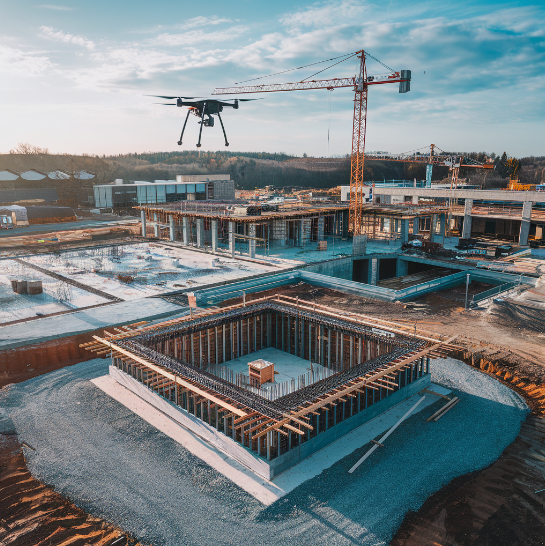
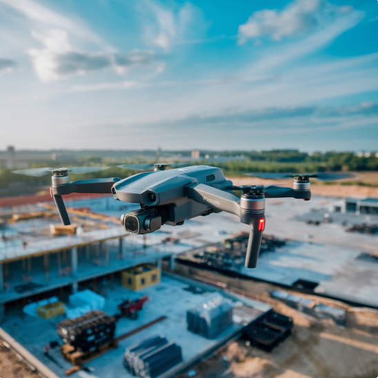
Introduction: Drone Surveying For Construction

The construction industry has greatly benefited from the advancement of drone surveying as skills and sight becomes faster and cheaper. These UAVs (Unmanned Aerial Vehicles) collect aerial photographs or 3D modeling which allow experts to cover huge regions significantly faster than before. Surveys done by drones enhance site information, progress monitoring, and safety evaluations by reducing mistakes associated with manned missions. And this is just the beginning, as even simple topographic mapping and bulk volume estimates become exercises performed with drones, the construction business will continue changing for the better. With time, the demands of the construction industry will further incorporate the inventions on this technology hence enhancing the quality of constructed projects.
How Drone Surveying Works
The capture and assessment of information in drone surveying uses very sophisticated technology. The procedure begins with a drone that has highly detailed cameras and memories. The drones are flown remotely allowing them to go around the construction field gathering information from different aspects.
The data created comprised images and videos together with measurements. This information is then advanced through particular software in order to produce maps, three dimensional images and surveying. Those outputs provide an extended perspective of the site at hand, enabling the construction teams to strategize well.
This is one of the strengths of flying a drone to gather information. Conventional method of carrying out the surveys takes a long time and requires a lot of workforce but with the use of drones huge areas can be worked on within a short time. In this regard, it is very useful in the construction industry that is faced with time constraints in regards to construction purposes.
Benefits of Drone Surveying in Construction

Drones have multiplied in popularity in construction due to all the benefits additional technology brings to the project. Some of these include:
Improved Accuracy
Drones present a very simple way of acquiring highly accurate spatial data through images and measurement taken from various viewing angles. This accuracy comes crucial especially in site planning, grading, and layout.
Enhanced Safety
Although construction sites can be dangerous, drones can provide access to dangerous aerial parts which people cannot work. This helps to prevent accidents and injuries, making it a healthier workplace.
Cost Savings
There is always a cost associated with getting the drone, and although procuring the particular equipment might be higher, the cost which is incurred in the long run is estimated to be minimal. This is because the use of drones cuts down on manual work and reduces mistakes hence saving on costs.
Real-World Applications of Drone Surveying
Use Of Drones. The technology’s popularity has already shown exciting results in the construction activities all over the world. Let us see some areas where the use of drones has really been beneficial:
Site Inspections
Drones come in handy for site inspections so often that allow project managers to keep track of the site so as to know its current status and any challenges that may arise. Such foresight in tracking a project prevents possible issues from aggravating and thus coming up with solutions becomes fast.
Earthwork Volume Calculations
Making earthwork volume calculations manually may be effective on occasions, but it does take a long time. Drones are much faster in terms of determining as well as calculating volumes for effective material handling.
Infrastructure Maintenance
Construction drones are also utilized in inspecting the sites in foreign infrastructure projects, determining the state of roads, bridges and pipelines. This temperance cuts down the costs used for maintenance and also enhances the useful life of important assets.
Case Studies in Drone Surveying

To understand better how drone surveying capabilities work, let us consider several instances in which drones surveying has been effectively applied:
Highway Construction Project
In consideration of a large highway building project, the audience seeks to understand how drones would assist in the intake and therefore all the construction phases. This helped the project team to control and make unplanned changes as required within a 20% margin of the project timelines.
Urban Development
For the purposes of site planning in an urban development project, UAVs were used in aerial imaging technology. There was better accuracy in the images leading to better design and layout options which are cost effective.
Renewable Energy Installation
Drones were very instrumental in the renewable energy project where solar panels were installed. The very possibility of flying on top of the buildings where the solar panels were installed greatly sped up the processes.
Industry Insights on Drone Surveying
To expand our knowledge on the relevance of drone surveying, we will start with those who already applied the technology:
People wise, John Smith, Construction Manager
“Drone surveying has changed our working methods completely. It is adequately efficient because it gives us accurate figures that let us make decisions without wasting time. The level of precision and timelines is out of this world.”
Also, Sarah Johnson, Civil Engineer
“The use of drones for the construction site has enhanced safety… a whole lot. It is now possible to examine structures where people would have been in great peril. This tech is revolutionary for our industry.”
Lastly, Michael Brown, Project Lead
“Drone surveying is now entirely integrated into our process. It helps us to deliver projects within the scheduled time frames and quality is guaranteed. It is a technology that is advisable to all the construction firms.”
Challenges and Considerations

The advantages obtained when surveying using drones are obvious, however, there are some drawbacks and things that need to be taken into consideration by construction businesses:
Regulatory Compliance
The use of drones for specific purposes is regulated, and related permits are required. Building firms have to abide by several local regulations and obtain all the requisite permissions.
Data Management
Drones can undertake several missions coughing a lot of data. Such critical information has to be well managed and reasonable storage systems also adopted with it.
Training and Expertise
There are some skills that are required to fly drones and to evaluate the images captured. Construction teams must take these drones seriously and hence invest in training and recruitment of professionals to utilize drones properly for construction.
The Future of Drone Surveying
The future prospects of drone surveying in construction look bright and there are exciting advancements to expect:
AI and Automation
Integration with artificial intelligence (AI) and automation will further enhance drone capabilities. The AI algorithms will play a vital role in the analysis of data enabling one to understand deeper.
Integration with BIM
Building Information Modeling (BIM) is one of the special technologies used in our area of construction. Increasingly, drones will be linked to a BIM system to provide timely information and enhance workflow.
Sustainability
The use of drones can also be helpful in providing strategies to promote sustainability by way of avoiding wastage and improving the management of available resources. This is consistent with the tendency of most industries today to embrace greener practices.
FAQs: Drone Surveying For Construction
How can drone surveying be defined in construction?
In the field of construction, drone surveying refers to the capture of high-resolution images, videos and topographical data using drones (unmanned aerial vehicles or UAVs) mounted with cameras, GPS and other sensors on construction sites. This data is then utilized for various purposes including mapping, progression monitoring, inspections and in making 3D models.
How effective is drone surveying for construction projects?
A drone survey is efficient with an accuracy level often going to 1-2 cm. More so, it can do field surveys, and mapping due to other advanced sensors attached to it apart from LiDAR; like RTK (real time kinematic) technology.
How do drones surveys take compared to traditional methods?
Yes, drone surveys are better and quicker than the conventional plans. What would have taken the survey crew days to accomplish can sometimes be achieved by the drones in a few hours depending on the complexity of the site.
Is it permissible to operate drones on an active construction site?
Yes, in most cases drones are considered safe when used on construction sites by qualified users in accordance with safety measures. Drones lessen the need for workers to enter hazardous zones, in doing so reducing occupational hazards. Nevertheless, operators should always follow the local regulations as well as ensure reasonable distances are kept.
Conclusion: Drone Surveying For Construction
The construction business has been reinvented by some fresh technology – drone surveying. It enables speedy, precise, and inexpensive site analysis, monitoring, and inspection of construction projects. Adopting drone technology allows construction specialists to enhance efficiency in the project flow, increase safety, and improve the quality of work. And as the capabilities of drones advance, so will their use in the construction sector as a new standard for speed and accuracy.
This article explains how drone surveying affects construction activities and will be quite useful to professionals looking into the prospects of utilizing drone surveying in their construction processes.
